 |
4. A Comparison of Urban Sprawl Discussions
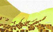
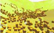
4.4 Outlook Depending on the underlying logic of the site, the internet offers direct access to detailed background information via so-called "links". Previous methods of information gathering beyond the original text had relied on complicated research, based on specific keywords. Beyond simple numeric or verbal descriptions, the medium internet offers the option of visually interpreting data, an enormous improvement, specifically when it comes to geographical or topographical facts which cannot be sufficiently regarded in spatial planning. The implementation of computer assisted methods of visualization offers possibilities of showing planning in a realistic manner and improves flexibility and attractivity beyond traditional methods of visualization. The possibility ensues to "transport the spectator into the future world of planning, staged with the aid of a perfect model that is realistically lighted in front of a natural background including a backdrop of natural sounds." [Hirche 1982] This causes an increase of understanding for the planned project and allows everyone the possibility of directly voicing comments while the process of planning is underway. The possibilities of realism are so far-reaching, that "the results of a combination of real imagery or sequences of real imagery (video) with computer-generated photo-realistic depiction is indiscernible from photographs of real situations provided the visualization is done carefully." [Lehmkühler 1999] The implementation of new tools appears sensible in principle, provided "current tasks can be solved better (faster, with more precision, simpler,...) or if it is possible to find a solution to a problem that was not previously solvable with a reasonable degree of effort." [Schrenk 1997]
|
|||||
 |
||||||
 |
||||||
 |
||||||
| 4. Introduction 4.1 Discussion in the USA 4.2 Discussion in Germany 4.3 Conclusion |